OUR CHRISTMAS EVE HIKE
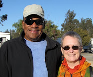
 We found it! A few days ago, I mentioned that we had tried to find the ruins of Presidio Santa Cruz de Terrenate, one of the forts the Spanish planned to construct on the northernmost frontier of their New World holdings. We weren't successful last week, so Odel, Rosanna and I set out on Christmas Eve (day) to find it - and another geocache in the area. Beautiful weather once again: we got to tie our jackets around our waists and hike in short-sleeved shirts.
The site chosen for the Presidio was on the sweep of a high plain, with views of Cochise County's numerous mountain ranges all around, as well as views into Mexico (which wasn't Mexico in 1776, of course). Our easy hike lead across level ground; we could actually look around at the view rather than watching our feet.
We found the geocache very near to the trail, a good start to the day. I brought along a small book called "Scats and Tracks of the Desert Southwest", a guide to the poop and pawprints of the animals of the southwest, which I had registered on BookCrossing, and a big KIVA button. We exchanged these treasures for a slim book about cactus for Rosanna and a yo-yo for Odel, who turns out to be rather talented in that arena. The flat, easy hike ends in a loop on a bluff overlooking the San Pedro River. It is rather pathetic to read the history of the short-lived Presidio. The Spainards, using European-style fortress design, were no match for the Apache who were defending their homelands.
This cross and plaque, placed by warrant officers from Fort Huachuca, the current-day military base nearby, memorializes the soldiers and their captains - around 90 people - who died in the four year period that they tried to establish the fort. As usual, there is no memorial for the probably unknown number of Apache who died defending their land, their families, and their food supply from the predations of the Spanish. Abandoned in 1780, before completion, now there is little of the Presidio left - mostly the rock foundation. Stubs of adobe walls do still exist in places, though, which seems amazing to me. Each year, volunteers from various public lands agencies apply a mud "cap" to the tops of the remaining walls, called the "sacrifice layer". This mud erodes through the year, protecting the original adobe from the elements so we hikers have something fascinating to view as we prowl around.
The site has numerous intrepretive signs explaining the form of the fort and the variety of uses for the native plants. Benches have been placed about every 1/4 mile along the hike - we got to eat our lunch sitting on a bench for a change!
The day would have been perfect except for one thing: it appears that I lost my driver's license and my health insurance card, which I was carrying in my pocket, somewhere along the way! If YOU hike the trail and find them, will you please mail them to the address on my driver's license?? Muchas gracias!


No comments:
Post a Comment